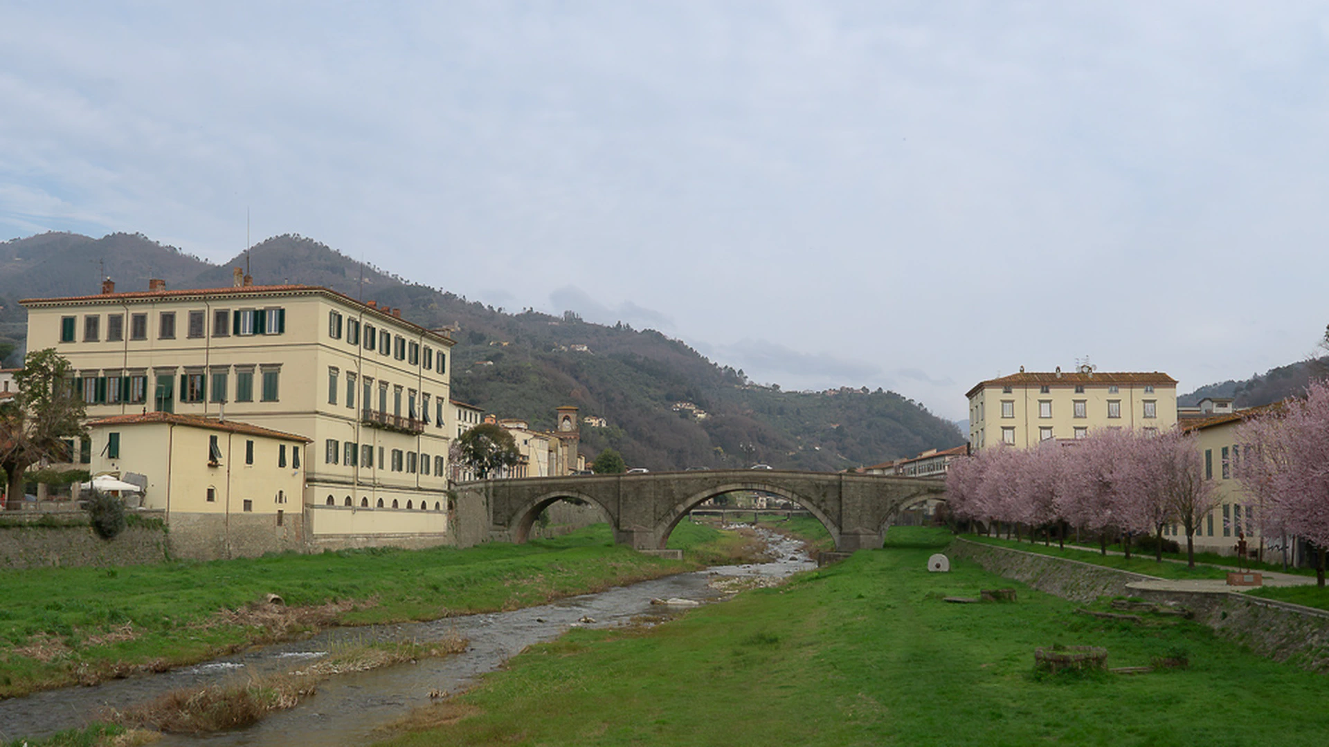

I'm Stefano, and I guide people through the Tuscany most tourists never see. Want to hike in Tuscany with me?
Last updated 16 October 2026
Pescia is known for its flowers, its paper mills, and its medieval centre.
What most visitors overlook is its position as a quiet gateway to some of Tuscany’s most varied hiking territory.
Within an hour of the town, the landscape shifts dramatically, from the gentle hills of the Valdinievole to high Apennine ridges, glacial lakes, and ancient forest reserves.
If you’re planning hikes from Pescia, you have more options than you might expect.
And some of the best ones don’t even require a car.
Browse the full list of guided hikes available from the Pescia area to find the right experience for your pace, fitness level, and interests.
Curious about the hills around Pescia? Get a local’s picks in a written Expert Brief. Already in Tuscany? Send me your dates on WhatsApp and I'll tell you what we can do together, and when.
No Car? No Problem: Three Train-Friendly Hikes
One of the underrated advantages of staying in Pescia is the rail connection.
The trains out of Pescia put three excellent hikes within easy reach. No driving required.
Acquedotto Nottolini
Take the train from Pescia to Lucca in roughly twenty minutes.
From there, one of the most architecturally striking walks in all of Tuscany begins almost immediately.
The Acquedotto Nottolini follows a 19th-century neoclassical aqueduct across the countryside. (check my blog post about photographing the Nottolini Aqueduct)
Lorenzo Nottolini designed this extraordinary structure in the 1820s to carry water from the Guamo springs into the city of Lucca.
What he built was not just infrastructure. It was a procession of arches that frames the landscape in a way no ordinary path can.
The route covers 9.1 km with only 50 metres of elevation gain.
This is genuine flat walking, suitable for all fitness levels.
You move through farmland, olive groves, and quiet countryside, with the aqueduct as a constant companion overhead.
It is an easy hike in the best sense: not boring, but genuinely gentle.
For anyone who wants the feeling of discovery without physical challenge, this walk consistently delivers.
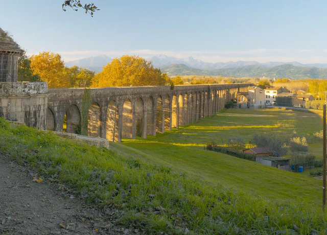
Nottolini Aqueduct
The aqueduct doubles as a sundial. Once a day the light runs straight down its corridor of arches, at a time that shifts through the year.
- About 3 hours
- €165 per group
- Reachable by train
- Longer route to a view over Lucca, on request
Easy · 9.1 km (5.7 mi) · 50 m (164 ft) ascent
View this hikeRocca di San Paolino — Ripafratta
The same Lucca line also opens up a completely different experience: medieval military history combined with natural forest.
The Rocca di San Paolino sits on Monte Pisano above the village of Ripafratta.
This fortress was strategically positioned to control the Serchio valley, a contested passage between Pisa and Lucca for centuries.
The hike is short at 3.3 km, with 130 metres of elevation gain, and rated easy.
But what you find at the top makes the effort worthwhile.
The ruins command a wide view across the plain, and the woods on the surrounding slopes feel ancient and enclosed.
This combination of history and habitat in a compact route makes Ripafratta a particularly satisfying half-day outing.
Passo di Dante — San Giuliano Terme
The Pisa–Lucca line also reaches San Giuliano Terme, about 45 minutes from Pescia by train (40 by car).
From the station, a steady climb through olive groves and Mediterranean woodland leads to Passo di Dante, a narrow passage through the Monte Pisano ridge traditionally linked, more by legend than certainty, to Dante Alighieri in exile.
The appeal is the contrast: you start at a spa town on the edge of the plain and within an hour you’re at a threshold between two landscapes: the Pisa coast on one side, the Serchio valley on the other. Allow 2–3 hours return.

Thirty Minutes by Car: The Acquerino Forest
For those willing to drive, the rewards increase significantly.
The Acquerino area represents one of the finest forest environments in the Tuscan Apennines.
Two protected reserves occupy the same continuous landscape, divided only by an administrative boundary.
On the ground, the forest doesn’t acknowledge the distinction.
You move through mixed broadleaf woodland (oak, chestnut, beech) that becomes increasingly enclosed and atmospheric as elevation rises.
The managed reserve status matters here.
Hunting is restricted, development is absent, and the priority is conservation. Deer are common. Woodpeckers announce themselves before you see them.The undergrowth is undisturbed.
In autumn, the forest floor becomes something else entirely, a productive mushroom habitat that rewards slow, attentive walking.

Acquerino-Cantagallo
The path climbs into ancient beech forest with the canopy closed overhead, and on most days we meet almost nobody.
- About 6 hours
- €240 per group
- Shorter or longer day on request
Medium · 9.5 km (5.9 mi) · 350 m (1,148 ft) ascent
View this hikeFurther Into the Apennines: High Ridges
When the objective is the high Apennines (real mountain terrain, exposed ridges, and glacial landscapes), the Appennines delivers.
From Pescia, the peaks of the Tuscan-Emilian Apennines are roughly an hour’s drive.
The effort is worth it.
Scaffaiolo Lake and Monte Gennaio
For those ready to commit to a full mountain day, two further destinations round out the high Apennine offering.
Scaffaiolo Lake sits at 1,775 metres in a hollow right on the main ridge.
It is one of the few high-altitude natural lakes in the Tuscan Apennines, and the light at this elevation, particularly in the early morning, is exceptional.

Lago Scaffaiolo
Once you’re up, the path runs along a broad, grassy crest to the lake, with Tuscany on one side and Emilia-Romagna on the other.
- About 6 hours
- €240 per group
- Shorter or longer day on request
Medium · 9.5 km (5.9 mi) · 370 m (1,214 ft) ascent
View this hikeMonte Gennaio at 1,814 metres offers 360-degree summit views across mountain ranges extending in every direction.
Both hikes depart from the same general area of the Appennino Pistoiese and can be planned together with appropriate timing.

Monte Gennaio
From the summit you look down into the Orsigna valley, where the writer Tiziano Terzani spent the last months of his life.
- About 6 hours
- €255 per group
Medium-Hard · 9.5 km (5.9 mi) · 500 m (1,640 ft) ascent
View this hikeEast Past Prato: The Calvana and Its Wild Horses
Drive east instead, past Pistoia and Prato, and a long grassy ridge called the Calvana rises behind the city. A herd of wild horses lives on top of it. Nobody fences them in and nobody feeds them. It’s very unlikely to walk the ridge without meeting them, and I’ve written more about them in my guide to the Calvana and its wild horses.
The trailhead is about 56 km from Pescia, roughly an hour by car. The climb is about 560 m, almost all of it at the start, on wide paths with nothing exposed. Up on the ridge we walk in the open through hawthorn meadows and cross Monte Maggiore (916 m), the highest point. I plan five and a half hours with breaks. I take five people at most on this one, children included, because there’s very little room to park at the trailhead. If you don’t have a car, tell me when you book and I’ll help you find a solution.
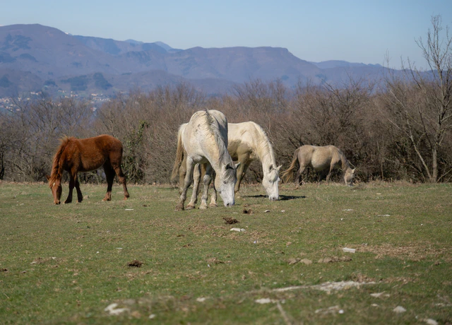
The Calvana
Hawthorn bushes dot the high pastures where the wild horses graze, and in spring they flower white. Almost nowhere else in Tuscany looks like this.
- About 5.5 hours
- €290 per group
Medium · 9.9 km (6.2 mi) · 560 m (1,837 ft) ascent
View this hikeA Different Direction: Padule di Fucecchio
Most hikes from Pescia go uphill.
This one goes flat, and the experience is something else entirely.
The Padule di Fucecchio is Italy’s largest inland wetland, located in the Valdinievole plain roughly thirty minutes south of Pescia by car.
The terrain could not be more different from the Apennines: no elevation gain, no forest, no ridge views. Instead: open water, reed beds, the sound of warblers in every direction, and morning light skimming flat across the surface of a landscape that feels unlike anything else in Tuscany.
The birdlife is exceptional. Grey herons, little egrets, marsh harriers, thousands of waterfowl in winter. In spring, mixed breeding colonies of herons and egrets occupy the trees above the water in a spectacle that has no equivalent in the mountains.
If you are based in Pescia for more than a day, the Padule is worth at least one morning of your time.
Svizzera Pesciatina: Still to Come
There is one corner of the Pescia hinterland that deserves its own story entirely.
The Svizzera Pesciatina (the ‘Swiss Pescia’) is a cluster of villages scattered across the hills northeast of the town.
The name was given by travellers who found something unexpected in the folds of these valleys: cool air, rushing streams, dense chestnut forests, and a pace of life that seemed to belong to another world.
This is deeply local Tuscany.
Stone villages that grew from the hillside rather than being imposed on it.
Paths connecting communities that once relied entirely on foot travel.
A landscape shaped over centuries by chestnut cultivation, water mills, and seasonal patterns of farming life.
I am preparing a dedicated hike through this area.
It will follow old mule tracks and stone paths through the heart of the Svizzera Pesciatina, connecting landscape and local history in a route that cannot be found on standard trail maps.
A booking option for this hike will be available here soon.
The Bigger Picture
What makes Pescia genuinely interesting as a base for hiking is precisely its lack of obvious fame.
Florence, Siena, Lucca. These destinations manage their visitors carefully, because the visitors are the point.
Pescia is different. The territory around it rewards curiosity, not itineraries.
Whether you arrive by train for a flat walk along a historic aqueduct, or drive into the high Apennines for a full-day ridge route, the experience is consistently low-crowd and high-quality.
That combination is increasingly rare in Tuscany.
It is also, in my view, what guided hiking is for.
Not to take people where they could go independently, but to take them where they wouldn’t think to go, and to make sure that what they find there makes sense. If you’re considering a guide for these trails, here’s what to look for when choosing one.
The landscape around Pescia rewards that kind of attention.
Explore the Pescia Area on Foot
Looking for a guided hike near Pescia, whether train-friendly or deep into the Apennines? Book a consultation call to find the right route for your schedule and fitness level.