
I'm Stefano, and I guide people through the Tuscany most tourists never see. Want to hike in Tuscany with me?
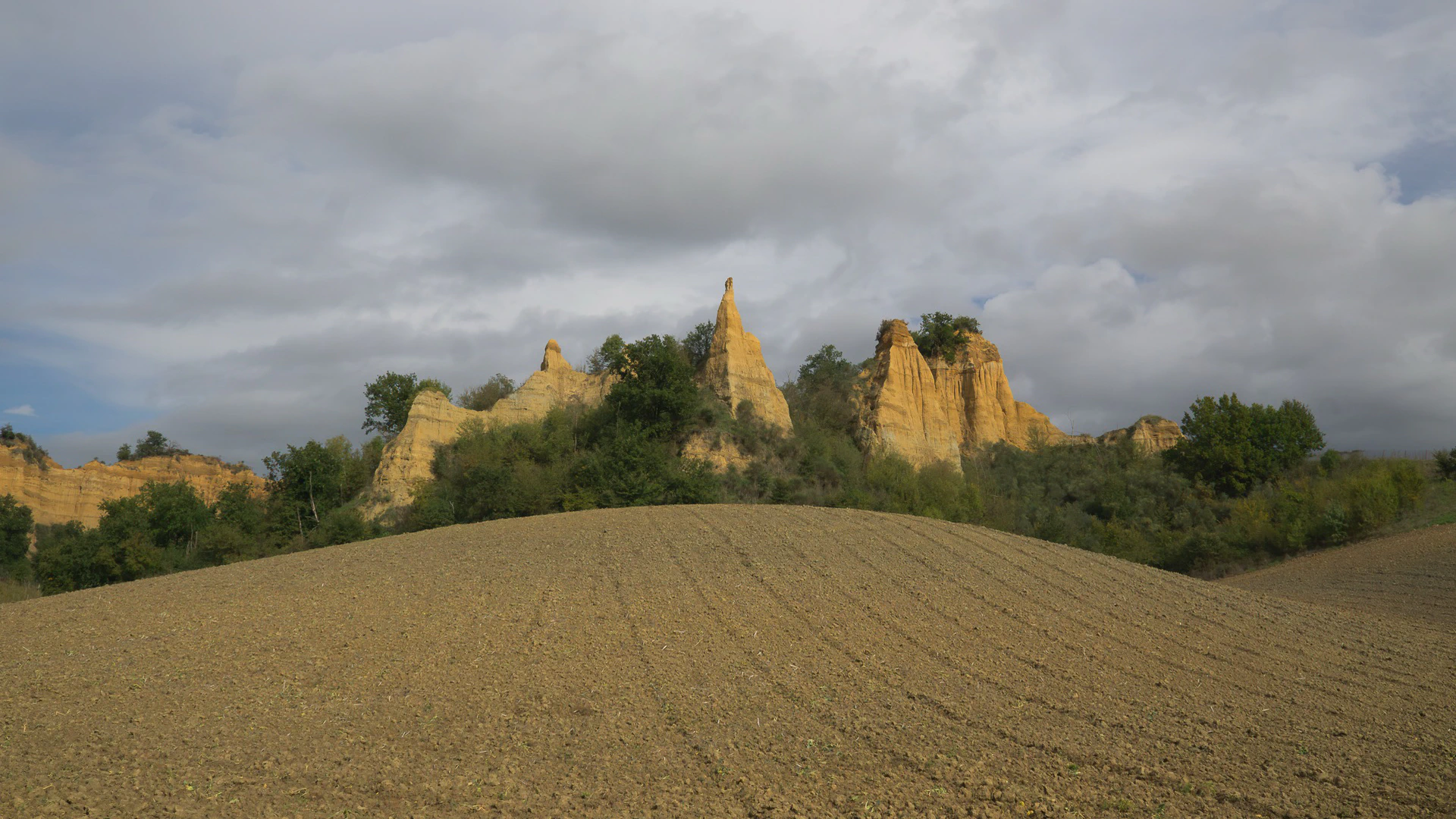
Forty-one kilometres from Arezzo, and forty-two from Florence, the Arno valley does something no guidebook had prepared me for. The olive groves stop at a cliff edge, and below them stand towers of pale yellow sand, some close to a hundred metres tall, cut into fins and spires and amphitheatres. These are the Balze del Valdarno, and I walked among them for the first time in October 2026, with a guide who has known the paths for years. I’m writing this before I’ve fixed my own version of the day, so read it as a first report, with the numbers still to come.
If you’re staying in Arezzo, or in Florence, and you want one day that isn’t a hill town or a museum, this is the day I’d now put forward.
What the Balze del Valdarno Are
For more than a million years the upper Valdarno, the stretch of valley between Florence and Arezzo, was a lake. The streams coming down off the Pratomagno ridge filled it with clay, and later with sand and gravel, layer on layer, while elephants, rhinoceroses and hippos lived and died on its shores. People have been pulling their bones out of these sands since at least 1596, and the best of them sit in the natural history museum in Florence, a collection the International Union of Geological Sciences listed among its heritage collections in 2024.
When the lake drained, the Arno and its tributaries began cutting down into the old bed, by something like 150 metres in all. The lower clays are soft and the upper gravels are hard, which is the whole trick: the hard cap protects whatever sits under it, the soft ground beside it washes away, and you’re left with a wall that stays vertical while the land around it drops. Rain keeps working on them, and the shapes move from decade to decade.
The area became a local protected area in 1998, spread over Castelfranco Piandiscò, Loro Ciuffenna and Terranuova Bracciolini. Some tourism copy has started calling it the Grand Canyon of Tuscany. I’d skip the comparison: the scale here is a village, and that’s exactly why a single day works.
Leonardo knew this valley. In the Codex Leicester he wrote that the upper Valdarno had once been a lake, and some scholars see these pinnacles, and a bridge on the Arno upstream at Arezzo, in the landscape behind the Mona Lisa. Others disagree, and nobody has settled it. I’ve laid out the whole argument, with the rival locations, in my post on the Mona Lisa background.
A Day Trip from Arezzo, or from Florence
The walk starts from Castelfranco di Sopra, one of the new towns the Florentine Republic laid out on a grid in 1299 to hold this side of the valley. From Arezzo it’s 41 km by road, from Florence 42, from Prato 63.
The valley floor has stations on the Florence to Arezzo railway line, at Figline, San Giovanni Valdarno and Montevarchi, and Castelfranco sits above them on the hillside. The last leg up from a station is the part I still have to work out for anyone without a car. If that’s you, tell me when you write and I’ll help you find a solution.
A day here sits naturally on the Setteponti, the old road that runs along the foot of the Pratomagno from the Florence side towards Arezzo, past the Romanesque parish church of Gropina above Loro Ciuffenna. I’m a hiking guide and I’ll leave the churches to you; what I can do is walk you through the ground itself.
Walking Among the Pinnacles
Signed paths leave from the edge of Castelfranco di Sopra and loop below the cliffs, so you can walk here on your own.
What you get with me is the day I’m building out of that network: the approach that puts the light where you want it, the stops where the geology explains itself, the Leonardo story told in front of the thing it’s about, and a pace that lets you photograph instead of march. The day I walked it, the pinnacles went from bone-pale around midday to gold late in the afternoon, and every photo on this page is from that afternoon.
The ground is easy: paths and farm tracks through olives, short ups and downs, nothing exposed. Sand and clay turn slippery after rain, so a wet day means a slower, shorter version. In July and August I’d start early, as anywhere in Tuscany below a thousand metres.
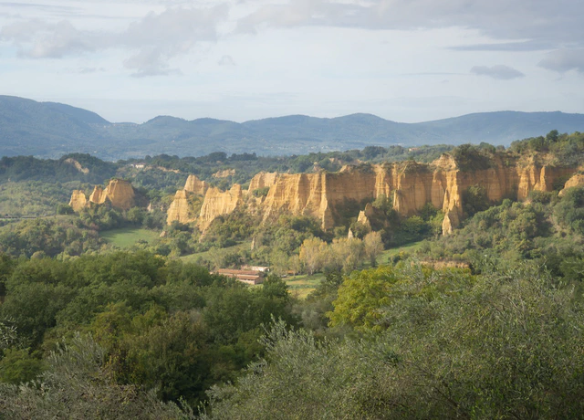
The Balze del Valdarno
Towers and walls of pale sand and clay, left behind by the lake that filled this valley before the Arno cut through it. Late in the afternoon they turn gold. An easy walk, 41 km from Arezzo and 42 from Florence.
Easy
View this hikeIf Your Base Is Florence
From Florence this is the one walk I guide that points south-east. Everything else I run from the city goes north, to the Calvana ridge, the Acquerino forests and the Apennine lakes, and all of those are in hiking near Florence. The Balze are the contrast: no climb, no forest, and a landscape that looks like it was shipped in from somewhere much drier.
Frequently asked questions
Ask Me for a Date at the Balze
The walk isn’t priced yet, but the request form already works. Send me your dates and how many of you are coming, and I’ll come back with the route, the hours and what it costs as soon as they’re fixed. Nobody is committed to anything until you’ve seen them.